About This Project
My research lab deals with research on the applied vegetation ecology by means of airborne and spaceborne remote sensing data. Here, we deal with the main question of "can remote sensing contribute to monitor essential biodiversity variabes (EBVs) for Iranian forests? ". In this project, we will combine field- and remote sensing methods for quantifying a set of EBVs for fragile and partly degraded forest ecosystems in northern and western Iran.
Ask the Scientists
Join The DiscussionWhat is the context of this research?
Forest biodiversity has significantly declined during the recent decades as a result of multiple factors such as deforestation and climate change-induced events. Advances in remote sensing have enabled to use various, partly free, data sources for ecological research e.g. on wildlife niches and vegetation dynamics. Iran belongs to the countries with low forest cover, but includes unique forests, e.g. the Hyrcanian or Caspian forests that stretch out from sea level up to an altitude of 2,800 m and encompass over 80 woody species that have been partly long extincted in Europe. Remote sensing studies to quantify and monitor the dynamics of biodiversity variables in Iran are rare and very recent. Here, field and remote sensing data will be coupled to extend our knowledge in this context.
What is the significance of this project?
In this project, I will foster interdisciplinary joint research between remote sensing experts and ecologists to derive a set of biodiversity variables (including tree structure and health) for forest ecosystems in Iran. Thus, this research associated with this project will contribute to better understanding ecological phenomena (in particular tree health and structure) and their spatio-temporal dynamics in fragile Iranian forest ecosystems. This research will specifically result in statistical knowledge (model performance and its uncertainty) and spatial maps of forest health and structural indicators in Iran. This would support both science and practice that are interested in not only habitat conservation per se, but also in decision making for its future.
What are the goals of the project?
Our first goal is to test the capability of airborne and spaceborne remote sensing data to quantify main essential biodiversity variables in deciduous northern Forests and semi-Mediterranean western forests of Iran. The second goal is to present a framework for joint use of field and remote sensing data to improve quantification of tree health, tree structure and tree types in Iran. The third goal is to find out data- and methods-driven differences between estimating essential biodiversity variables in those two ecologically-different forest ecosystems. Finally, the last goal is to upscale the sample plot-based forest health and structure to larger spatial domains (regional and state-wide levels), which expands the experimental results to practical results.
Budget
Despite tremendous potentials for research that has been proven by numerous high-ranked journal papers and internatinal projects (see here), my resarch lab (RSEEC) lacks basic research tools and hardware required for field-based vegetation inventory, including tools for tree height and diameter measurement, as well as fish-eye camera for canopy and leaf area index measurements. Due to the imposed international sanctions on Iran I have not been able to purchase these basic tools for my lab, which has seriously put the functionality of RSEEC in jeopardy. My university has also not been fully able to support me with the required lab equipments due to budject constrains. Therefore, a minimum amount of funding would provide my lab with the possibility with equipments for vegetation ecological measurements that are required for the subsequent estimation of biodiversity variables. Estimating remote sensing-enabled essential biodiversity variables is the core idea off the applied project.
Endorsed by

 Project Timeline
We will purchase the required forest inventory tools from December 2021 to February 2022. Then, field data will be collected on tree health and structure during March to September 2022. This will be followed by remote sensing data analysis for the two topics of "Describing Persian oak decline by UAV and spaceborne data" and "Remote sensing-assisted tree type mapping" during October to December 2022. Finally, two scientific manuscripts will be written form December 2022 to March 2023.
Oct 29, 2021
Project Launched
Oct 31, 2023
purchase of the required forest inventory tools
Jun 30, 2024
Field data collection on tree health (decline) and structure (height, diameter and canopy cover) in two different forest ecosystems
Oct 31, 2024
Remote sensing data analysis (UAV and spaceborne data processing, pint cloud data processing, geostatistical analysis and modeling)
Dec 31, 2024
Submitting two scientific manuscripts from the two above-mentioned studies
Meet the Team
Team Bio
As a forest ecologist, I established the RSEEC lab as the first of its kind in an Iranian Geomatics faculty. My team consists of me, three PhD students (Mr. Arvin Fakhri, Ms. Marzieh Ghasemi and Ms. Fatemeh Saba) and four M.Sc students, all working on various research topics ranging from forest health to tree biodiversity mapping using remote sensing data across Iranian forest ecosystems. Additional information on each student´s research topic will be provided if required by the backers.
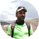
Hooman Latifi
I am an Associate Professor of Ecological Remote Sensing at the Dept. of Photogrammetry and Remote Sensing of the K. N. Toosi University of Technology and and the Dept. of Remote Sensing of the University of Würzburg. I am primarily a forest ecologist interested in geospatial data, methods and applications to answer ecological questions. My current research interests are applied spatial analysis of forest entities (structure, biodiversity and health indicators) by means of spaceborne and airborne remote sensing. In particular, I treasure dealing with drone and LiDAR--based applications for forest structure analysis, as well as multitemporal and time series of optical data for monitoring vegetation health and phenology.
Additional Information
1- Please follow updates on our latest publications, workshops, projects and students on our ResearchGate page:
https://www.researchgate.net/l...
2- The idea of remote sensing-enabled forest Essential Biodiversity Variables is originally inspired by the following publications:
Pereira et al. 2013, Science, DOI: 10.1126/science.1229931
Jetz et al. 2019, Nature Ecology and Evolution, DOI: 10.1038/s41559-019-0826-1
Latifi et al. 2021, Methods in Ecology and Evolution, DOI: 10.1111/2041-210X.13695
Skidmore et al. 2021, Nature, DOI:10.1038/s41559-021-01451-x
Project Backers
- 3Backers
- 1%Funded
- $32Total Donations
- $10.67Average Donation