Austin Hill

Austin Hill

Mar 27, 2016

Group 6 Copy 178
1
Please wait...

About This Project

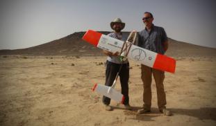
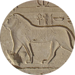
Unmanned Aerial Vehicles (UAVs, or drones) are revolutionizing archaeological landscape mapping. Using drones, we will conduct a high-resolution aerial survey of previously unknown prehistoric monuments and archaeological sites in the eastern Black Desert of Jordan. Aerial surveys such as this can be particularly useful for recording prehistoric structures that tend to be small and difficult to identify from satellite images.

Blast off!

Browse Other Projects on Experiment

Related Projects

Is depression contagious? An analysis using college roommates

Can depression be contagious? The answer still isn’t clear. Our research seeks to discover whether depression...

City Growth and Trade at the Ancient Maya Site of Alabama in Belize.

The goal of this project is to initiate archaeological survey and excavation at the Alabama Site in the...

Of Monks and Men: How medieval construction brought monasteries and lay communities together

How did the construction of monastic buildings push monks to cooperate with people outside their cloister...

Backer Badge Funded