Please wait...
About This Project
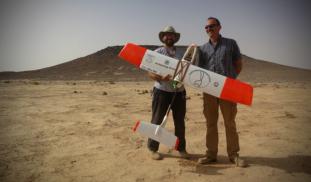
Unmanned Aerial Vehicles (UAVs, or drones) are revolutionizing archaeological landscape mapping. Using drones, we will conduct a high-resolution aerial survey of previously unknown prehistoric monuments and archaeological sites in the eastern Black Desert of Jordan. Aerial surveys such as this can be particularly useful for recording prehistoric structures that tend to be small and difficult to identify from satellite images.

More Lab Notes From This Project
Browse Other Projects on Experiment
Related Projects
When did we start the fire?
I will conduct a series of experiments looking at fire micro-residues in modern and archaeological contexts...
Fanteca Project: Student-led study of opiates and overdose in NYC
To address overdoses in NYC, it is important to know how many people are at risk, how many have had non...
Who’s there? Oh, it’s you! Vocal recognition in western gorillas
Individually distinct vocalizations allow animals to respond differently based on caller identity, sex...