About This Project
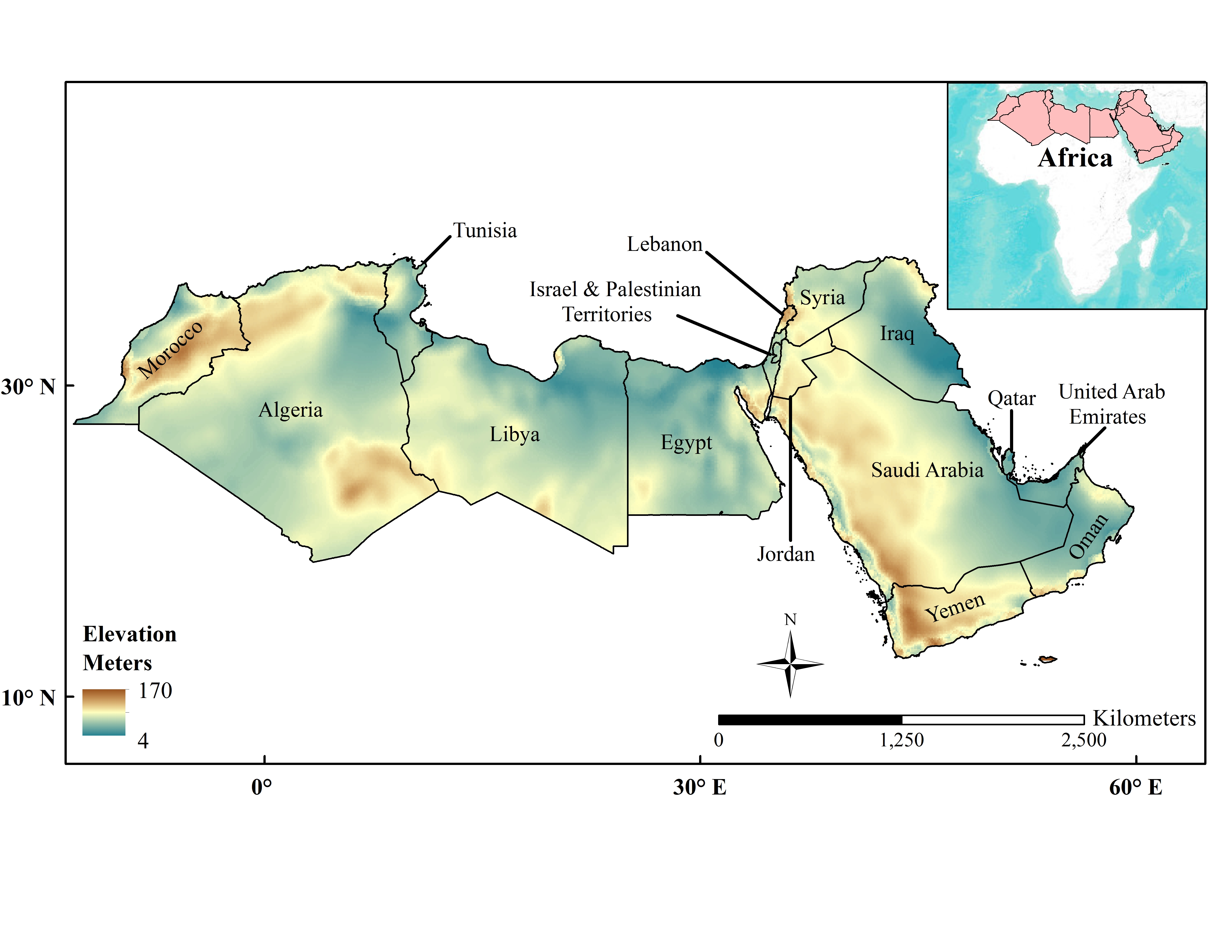
Groundwater resources are reliable insofar as their capacity to act as buffers to climate change, and to provide generally unpolluted freshwater. However, significant energy output is expended to pump groundwater to the surface, thus contributing to increases in greenhouse gases emissions, and in addition to inflating groundwater use cost. Our project will perform a regional spatial analysis in the Middle East and North Africa to determine areas suitable for solar-powered groundwater pumping.
Ask the Scientists
Join The DiscussionWhat is the context of this research?
This project is inspired by my Ph.D. research on the risk of groundwater scarcity and depletion in the Middle East and North Africa (MENA) region. Throughout my research, I became highly interested in examining the asymmetrical relationship between water and energy resources (a.k.a water-energy nexus), whereby weak dependence of energy production systems on freshwater systems is countered by a strong reliance of water extraction systems on fossil energy resources. Because of climate change and finite fossil fuels, the water-energy nexus is unsustainable. However, given the MENA region’s high solar potential, I believe a more symmetrical water – renewable (energy) is attainable.
What is the significance of this project?
Demographic and economic growth in the MENA region will drastically increase freshwater demand. Since 85% of the region is hyper-arid, with little to no surface water, the bulk of the water demand will be met by non-renewable groundwater reserves. Consequently, increased groundwater pumping will increase the amount of energy required for groundwater extraction.
Increase in energy use for groundwater extraction is problematic on two levels. First, it will increase pressure on already stressed fossil fuels resources. Second, it will exacerbate climate change effects by increasing greenhouse gas emissions.
Examining the potential for groundwater abstraction using solar energy will address the aforementioned concerns.
What are the goals of the project?
The funds will be used to purchase an ArcGIS 10.3 software, which will be used to handle data management, visualization, and analysis.
Determining areas in which solar potential is sufficient to produce enough energy in kilowatts per hour (kWh) to extract groundwater from their respective depths will require the following analyses. First, the amount of energy required to extract groundwater will be calculated as a function of depth to water table, hydrogeology, and pump properties. Second, solar irradiation datasets will be used to produce solar potential maps. The juxtaposition of the results from the two former processes will determine areas in which solar potential and hydrogeologic conditions suitably allow for solar-powered groundwater pumping.
Budget
The beauty of this project is its reliance on public domain datasets provided for free by NASA. Notwithstanding the provision of spatially and temporally consistent datasets necessary to achieve the project's objectives, satellite remote sensing data drastically minimizes the cost of scientific research, discovery, and innovation in many fields.
The organization, analysis, and visualization of our data and subsequent results, however, requires ArcGIS software. While alternative open sources GIS systems are available, ArcGIS's power, ease of use, consistency, and diverse array of toolsets renders it most effective for achieving this project's objectives within a short time frame.
A basic ArcGIS for Desktop License costs 1,500 USD.
Endorsed by
Meet the Team
Khalil Lezzaik
I received a Ph.D. in Water Resources and Remote Sensing at the University of Georgia, an M.s. in Engineering Geology at the University of Leeds, and a B.S. in Geology at the American University of Beirut. My doctoral dissertation focused on the integrated use of satellite remote sensing and GIS systems to examine groundwater scarcity and risk conditions in arid regions globally. I am currently interested in pursuing applied interdisciplinary research on water, food security, energy, and governance, with applications in developing countries and international development.
Lab Notes
Nothing posted yet.
Additional Information

Project Backers
- 6Backers
- 11%Funded
- $160Total Donations
- $26.67Average Donation

