Methods
Summary
Continues in bibliographical research
Research region
The state of Puebla (Figure 1) is located in the central-eastern portion of the Mexican Republic, bordering the states of Veracruz, Oaxaca, Guerrero, Hidalgo, Tlaxcala, Mexico and Morelos. The state of Puebla has 6'168,883 inhabitants, which represents 5.2% of the total of the country and 1.75% of the total area of the country (1).
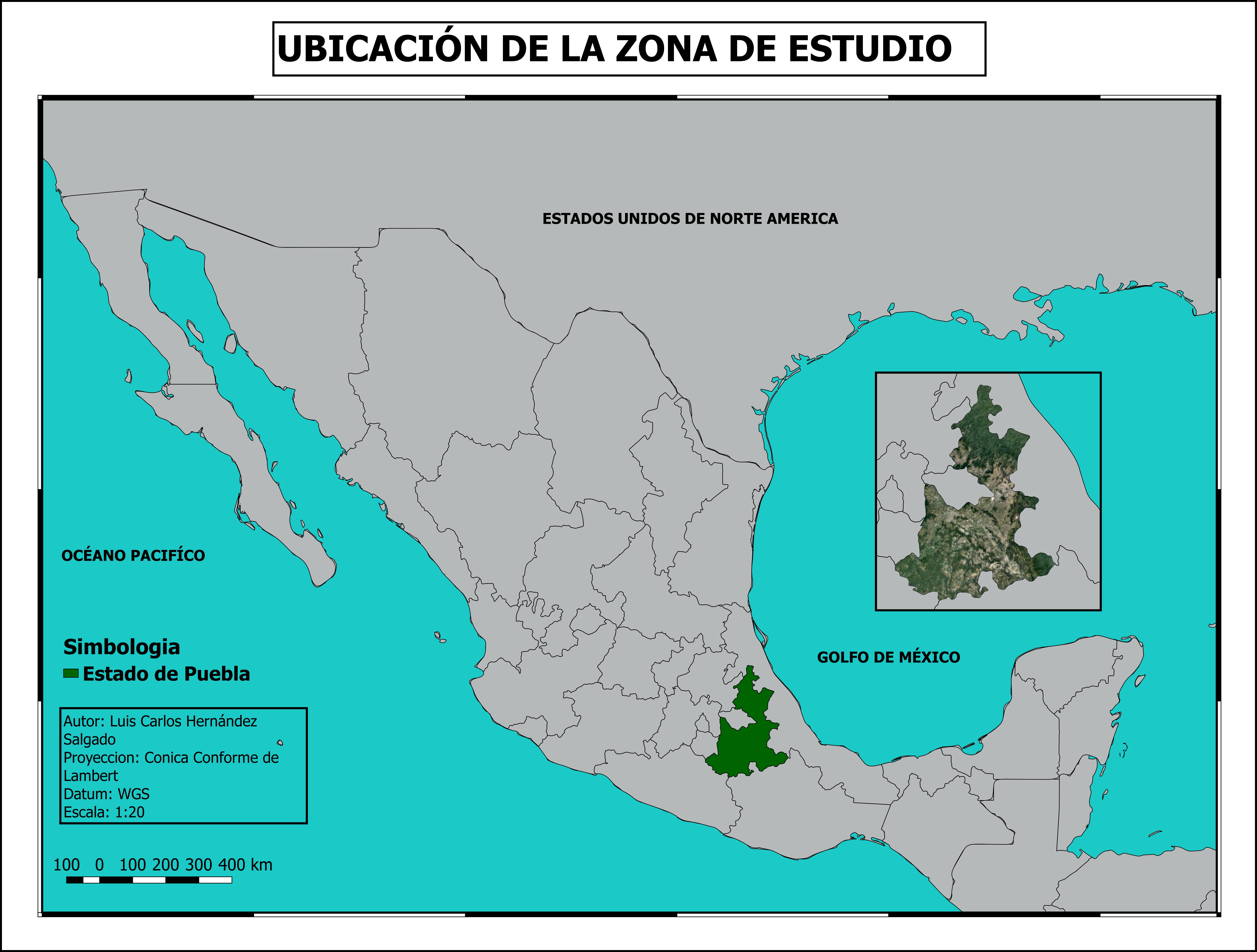
Figure 1. Location of the study zone in Puebla, México.
The state has a great diversity of climates, temperate climates are those that cover most of its territory, secondly the warm ones and thirdly the semi-dry ones, dry, semi-cold and cold. The north and northwest zones, belonging to the coastal plain of the North Gulf and those corresponding to the valleys of the Atoyac, Acatlán, Tehuacán and Petlapa rivers, have temperatures of 24 ° C or more, while the areas above the the 4000 m of altitude presents average annual temperatures between 2 ° and 4 ° C. The months with the highest rainfall are from June to September (1). The types of vegetation found in the state of Puebla (Figure 2) are mainly forests, jungles and bushes, the rest is grouped in induced and hydrophilic vegetation as well as in agricultural areas (2). The state of Puebla has 4,426 plant species and 1,274 animal species. The most abundant families of plant species in Puebla are Asteraceae, Fabaceae and Poaceae, Pinaceae and Cupressaceae. In the case of mammals, 161 species have been recorded, represented mostly by the orders Chiroptera, Rodentia and Carnivoda. In danger of extinction there are six species: Romerolagus diazi, Tamandua Mexicana, Leopardus pardalis, Leopardus wiedii and Eira barbara. It has 67 bird families that represent 55% of the total wealth of Mexico, the best represented families are Parulidae and Tyrannidae (2).
The area with geothermal potential of Acoculco, Puebla is located about 85 km from the city of Puebla, and 65 km from the city of Pachuca, Mexico (19 ° 47' to 20 ° 02'N and 97 ° '55' 98 ° 20'O) and the Los Humeros geothermal zone is northeast of the state of Puebla, in the municipality of Chignautla, on the border with Veracruz (19 ° 38'45.80 "N and 97 ° 26'10.52" W) (3).
Sampling design
The sampling design will be based on the five environmental systems arranged in the study area, considering the geoforms and the types of vegetation. The stations will be based on a polar sampling system (4), with a distance of 10 km in diameter from the geothermal expression. The sampling stations will be selected randomly in the geothermal zones in a gradient distance from the emanation sites.
Sampling of organisms
The collection of organisms will be done in each sampling station, fall traps will be placed using a grid of 15 fall traps, 7 cm in diameter (5) and will be collected manually with entomological nets or tweezers.
Later they will be identified with specialized guides in the laboratory and, if necessary, samples will be sent to specialized molecular analysis laboratories for their identification.
Statistic analysis
One way ANOVA statistical tests will be performed to determine if there are differences between the variables with respect to the study area. Analysis of similarity and analysis of canonical correspondence will also be carried out to know the relationship between the presence / absence of species in each site and the environmental variables.
Protocols
Browse the protocols that are part of the experimental methods.