Register or sign in to continue.
Sherman Horn III

Sherman Horn III

Oct 24, 2016

Group 6 Copy 251
0

Looking at the Swamp: What the LiDAR "Sees"

You can probably tell from our last Lab Note what an incomparable aid LiDAR has been to settlement survey at El Pilar. The ability of LiDAR to "see" through the forest canopy revealed substantial settlement in central El Pilar and unexplored, monumental structures such as the Citadel. After the LiDAR survey, fieldwork at El Pilar focused on investigating newly recognized features by visiting them on the ground and recording them in more detail.

Documenting ancient residences on the outskirts of cities is an important part of settlement research, and our LiDAR imagery suggests that people built structures outside "downtown" El Pilar. Of particular interest to this project is the low-lying, seasonal swampy area to the northeast of the city center. This zone is boxed in red in the figure below.

(North is Up)

The ancient Maya preferred to live in elevated, well-drained areas that were ideal for farming,  and more ancient residences have been discovered near the center of El Pilar than anywhere else in the Reserve. LiDAR images suggest people also lived along the edges of the swamp to the northeast, although in lower numbers than in the city center.

(North is Up)

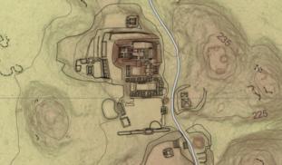
The image above is a blow-up of the boxed area from the LiDAR survey map. Take some time to explore it and zoom in on interesting features - there's actually quite a bit to see here, and we will point out some things below. The solid lines with numbers are contours, which show the relatively gradual drop-off in elevation as one moves from south to north, and the dotted line is an old logging road that runs through this section of the Reserve.

(North is Up)

And now for some explanation of what you are seeing, and what LiDAR can "see" in the swampy areas around El Pilar. The long, curvy features circled in blue are gullies formed by streams in the rainy season. When we surveyed parts of this area in May and June of this year, these features were completely dry - the rains came late, and the forest was still eagerly soaking up what little water fell from the sky. These dry creek beds are important to understanding how the ancient Maya may have used this area, because management of seasonal rainwater was necessary to support large populations away from permanent lakes and rivers.

Two examples of formal residential groups, each containing three structures built around a small patio, are circled above in red. These groups are similar to others built in central El Pilar, and they provide clear examples of how LiDAR can "see" small structures through the jungle foliage. We can also pick out some variation in the size and layout of structures in these groups, which may reflect important social differences between the people who built and used them. For example, the group enclosed by the larger circle appears to sit atop an elevated platform, which is visible as a darkened semi-circle connecting the perimeter of its three mounds. This would have required a greater labor investment to build than a group of structures constructed directly on the ground.

The small yellow circles highlight a sample of what we have called "features" or "anomalies," which are not as easily interpreted as the architectural groups circled in red. You will find many other similar features in the image, and they clearly outnumber formal patio groups in this low-lying area. Our survey this year showed that some of these "blips" were actually natural features, which included large mounds made by leaf-cutter ants, piles of debris from cohune palms, and areas recently disturbed by fallen trees; many others were isolated stone mounds that were built and used for purposes we don't yet understand. Our findings have implications for how Maya archaeologists interpret LiDAR data in settlement pattern studies, and we are seeking to answer the questions they raise about everyday life in ancient Maya cities.

Please wait...

About This Project

Aerial LiDAR surveys have been popular tools for mapping ancient Maya settlements through the dense rainforest canopy. LiDAR mapping at El Pilar revealed several previously unknown large structures, but many smaller structures in low, swampy areas were invisible to this technique. This project will develop a program of field-checking LiDAR anomalies to clarify the patterns of small structures in seasonal swamps, where settlement models predict people would not live.

Blast off!

Browse Other Projects on Experiment

Related Projects

A sociotechnical toolkit for coral conservation and regeneration

This project aims to develop a sociotechnical toolkit for deploying meaningful biotechnologies in coral...

Through the eyes of the afflicted: unraveling the Fentanyl crisis

This project explores the fentanyl epidemic by gathering perspectives from those affected—people with addiction...

Unveiling Desires: Exploring BIPOC BDSM Preferences

"Unveiling Desires'' explores BIPOC fetishistic desires using a unique dataset from voluntary fetish surveys...

Backer Badge Funded

A social science project funded by 77 people

Add a comment