Sherman Horn III

Sherman Horn III

HD Analytical Solutions, Inc.

Research Scientist

More

Published on Apr 30, 2017

Return to El Pilar!

We made our first working trip to El Pilar last Thursday, April 27th, which included a return to a small mound cluster on the periphery of the low-lying, seasonal swamp in the northeast of the Rese...

Group 6 Copy 110
Published on Apr 22, 2017

The Blog is Up!

I've actually got the blog up and running! You can find it here. I have a short introductory post and a funny (to me, at least) vignette about packing for a long field season and traveling to Beliz...

Group 6 Copy 70
Published on Apr 20, 2017

Welcome to BRASS Base!

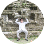
Greetings from BRASS Base in lovely Belize! Anabel has been here since April 8th, preparing the way for fieldwork, and Sherman arrived on the 15th with our new assistant James. Most...

Group 6 Copy 232
Published on Feb 09, 2017

New Year Update to Our Backers

The New Year got off to a quick start and continues at a breakneck pace! Anabel and I have been busy working on several aspects of our research at El Pilar, and we wanted to give you a quick update...

Group 6 Copy 65
Published on Nov 04, 2016

Success!

We did it! A huge thank-you to everyone who helped us exceed our funding target and win the Archaeology Grant Challenge! We were in a closely contested race with competition from some amazing archa...

Group 6 Copy 67
Published on Nov 02, 2016

Now You See It, Now You Don't: Why We Still Need Ground Survey

We've just uploaded a new video showing Anabel Ford and Belize Institute of Archaeology staff members surveying a terraced area in the forest at El Pilar. Archaeologists have known about ancient Ma...

Group 6 Copy 160
Published on Oct 26, 2016

Boots on the Ground: Survey in the Maya Forest

Our last three Lab Notes show how large, medium-sized, and even some smaller structures can be clearly seen in the El Pilar LiDAR images. Recognizing ancient Maya structures from the air and findi...

Group 6 Copy 153
More to come very soon!
Apr 20, 2017
People of the Swamp: LiDAR and "Invisible" Structures at El Pilar
View comment
Thanks for your comment and support, Pedro. This Experiment was designed to fund a part of the larger El Pilar Project, which Anabel Ford has been directing for over 20 years. Dr. Ford has been very interested in ancient Maya agriculture and has incorporated sustainability investigations into her larger research plans. She has been working directly with contemporary Maya forest gardeners, who grow and use a variety of forest plants and trees along with traditional staple crops (such as corn), to understand ancient Maya subsistence and agricultural economy. We will continue to incorporate this work into our future investigations and will address those issues more directly in upcoming lab notes. Thank you for raising this concern, and please don't hesitate to contact us if you have further questions about our work. Cheers!
Nov 17, 2016
People of the Swamp: LiDAR and "Invisible" Structures at El Pilar
View comment
Large structures at El Pilar are faced with limestone masonry blocks that were probably quarried from the ridge-lands around the center. Smaller structures, like the houses and other buildings that most people used, were made of perishable materials that haven't survived. Luckily for us, many smaller buildings were set on stone-faced platforms to raise them above the ground, and we find their remains as mounds of debris with stone alignments at their bases. We don't have good evidence for dedicated groups of architects or architectural artists as yet, but the scale and quality of construction suggests a specialized knowledge of how to build big, impressive monuments. Where, and in whom, architectural and construction knowledge was stored by the ancient Maya remains and interesting question. No evidence of war or invasion yet, although this is notoriously difficult to discover even at sites with unquestionably defensive fortifications. It's possible that excavations around the Citadel would turn up some clues, but we're not even sure that it was used for community defense at this point. As far as how El Pilar fit in with the broader "Maya Collapse," I can't tell yet. The center appears to have been abandoned, like many others in the Southern Maya Lowlands, probably sometime after AD 900 at the end of the Classic period. But there are some big issues with saying that kind of thing, because there hasn't been a lot of work done on what might be there from later times. I doubt that the area was depopulated as some people suggest, and we have some evidence of later architecture, but on a much smaller scale. At the very least, the political institutions did fail, and the tradition of divine kings was replaced by some other form of organization.
Oct 24, 2016
People of the Swamp: LiDAR and "Invisible" Structures at El Pilar
View comment
Looting is a huge problem in the Maya area, and there are several different ways potential looters can discover structures. Modern-day people have been living around El Pilar for some time, and it's possible that some people happened across the monumental structures while hunting in the forest or simply exploring. They could also have been noticed by chicleros, who harvested the sap of the chicozapote tree for making gum (think Chiclets), loggers, or others who made their living extracting resources from the forest. That's not to say that any of those groups are responsible for the looting - word spreads quickly about such discoveries - but to note that there were ample opportunities for people to explore, and illegally loot, the site before it was protected.
Oct 19, 2016
People of the Swamp: LiDAR and "Invisible" Structures at El Pilar
View comment
Great questions! The large dotted lines are modern roads that run through the Reserve. You can see that the one running through the monumental core corresponds to the north-south white line in the map in our previous Lab Note. Your next two questions are more difficult to answer. Estimating ancient Maya populations is tricky - anyone who tells you differently has not thought deeply about the problem or is trying to pull the wool over your eyes! That's because they are estimates that are based on samples, although they are often presented as if a census of the ancient population were taken. Anabel Ford has been working in the area for around 30 years, and she has developed a number of population estimates that account for things like landforms, soil types, the probability that all households dated to a certain period weren't actually occupied at the same time (especially when a period lasts for 300 years!), and the possibility that all these "residential" mounds weren't the primary residences of families. We don't have a revised estimate based on our LiDAR data yet - we're still field-checking those results - but an earlier estimate of over 20,000 people may be accurate. Dr. Ford has also estimated that between 176,000 - 182,000 people lived in the surrounding 1,288 square kilometers of the upper Belize Valley. More accurate population models and estimates is one of our primary goals for doing this research! As for distinct classes: well, yes, there do seem to be class divisions between people we might consider nobles and commoners, but it's a bit more nuanced than that. There probably were different "levels" of status within each of these groups, and we really don't know how rigid the boundary was between the two. We don't know who, if anyone, was able to own land, and we don't fully understand the relationships of production and consumption among the inhabitants of ancient Maya cities. These are questions many of us are working to address, but any definitive answers will depend on the accumulation of a lot more research from many different sites.
Oct 19, 2016
People of the Swamp: LiDAR and "Invisible" Structures at El Pilar
View comment