Methods
Summary
Our project will utilize powerful but low cost fixed wing drones to document an extensive area around Wadi Qattafi in the Eastern Desert of Jordan.
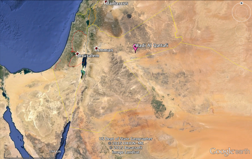 Location of Wadi Qattafi
We will visit the site twice in the Spring/Summer of 2016 and will spend a total of 4 weeks in the field mapping a 32 square-km area around Wadi Qattafi in the Black Desert.
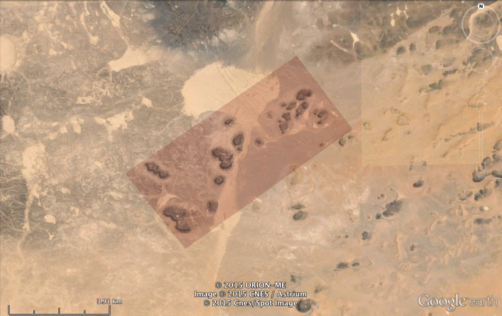 Survey area in Wadi Qattafi
Our drones utilize a powerful open source flight control computer (Pixhawk), that can be used to fly autonomous mapping missions. The drone is equipped with a small Canon camera, launched manually, and then sent off on individual missions to cover approximately 1 square-km per flight.
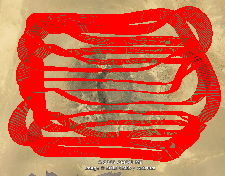 GPS track showing the drone's path during an autonomous mission in 2015.
The survey will result in a series of thousands of GPS-geotagged aerial images of the landscape. These image sets will be used to produce 3D models of the landscape, spatially accurate 2D maps, and Digital Elevation Models (3D ground elevation maps).
Video showing a 3D model of a single mesa
Challenges
We have extensive experience building and flying low-cost drones on a variety of archaeological projects. In June of 2015 we ran a pilot study in which we determined that it would be feasible to use autonomous fixed wing drones to survey this remote and rugged landscape. We successfully mapped a small portion of the total survey area.
Pre Analysis Plan
Analysis of the data from this project will also include you! We will generate a huge volume of high-resolution imagery of the landscape around Wadi Qattafi. These images will be posted online in a format that will allow volunteers to spend as much or as little time as they would like identifying the thousands of archaeological structures spread across this landscape. (We will post a link here to invite Experiment.com supporters to take part.)
Once we (and volunteers) have identified all of the archaeological features around Wadi al-Qattafi, we'll use spatial analyses to correlate the distribution of different kinds of structures to different landscape features for a research manuscript. Data on the location and concentration of archaeological features will also be used to decide on the location of future excavations.
Protocols
This project has not yet shared any protocols.