Methods
Summary
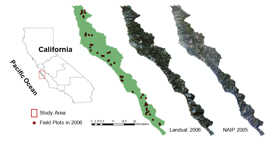 In this research we integrated h-res image samples with medium-resolution, full-cover Landsat images to map long-term, disease-caused tree mortality in the Big Sur, California ecoregion. We first applied MESMA (Multiple Endmember Spectral Mixing Analysis) to decompose all the Landsat pixels into three categories (GV, NPV and Soil) of forest damage. Second, we employed OBIA (Object-Based Image Analysis) to classify NAIP (National Agriculture Imagery Program) h-res image samples to determine disease caused tree mortality distributions, with the results from field data and Google Earth considered as the reference data. Third, we determined the consistency errors of Landsat NPV results through a comparison with the reference disease maps, which was followed by a development of an ecological niche constrain model to link the errors with a range of environmental and spatial-temporal factors. Finally, the models were applied to refine the Landsat results (from step one) to accurately map a decade of disease progression in the ecoregion.
Protocols
This project has not yet shared any protocols.