Austin Hill

Austin Hill

Mar 27, 2016

Group 6 Copy 183
1
Please wait...

About This Project

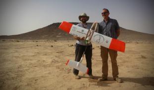
Unmanned Aerial Vehicles (UAVs, or drones) are revolutionizing archaeological landscape mapping. Using drones, we will conduct a high-resolution aerial survey of previously unknown prehistoric monuments and archaeological sites in the eastern Black Desert of Jordan. Aerial surveys such as this can be particularly useful for recording prehistoric structures that tend to be small and difficult to identify from satellite images.

Blast off!

Browse Other Projects on Experiment

Related Projects

Who’s there? Oh, it’s you! Vocal recognition in western gorillas

Individually distinct vocalizations allow animals to respond differently based on caller identity, sex...

Intuitions about Ownership Among Achuar Communities and the Misalignment of Intellectual Property Law

The ownership of knowledge is one of the most contested topics of our times, but little is known about how...

Was the Middle Bronze Age Civilization North of the Dead Sea Destroyed by Fire from the Sky?

This project will test the hypothesis that a cosmic airburst brought a sudden and catastrophic end to the...

Backer Badge Funded