Please wait...
About This Project
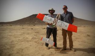
Unmanned Aerial Vehicles (UAVs, or drones) are revolutionizing archaeological landscape mapping. Using drones, we will conduct a high-resolution aerial survey of previously unknown prehistoric monuments and archaeological sites in the eastern Black Desert of Jordan. Aerial surveys such as this can be particularly useful for recording prehistoric structures that tend to be small and difficult to identify from satellite images.

More Lab Notes From This Project
Browse Other Projects on Experiment
Related Projects
Does tattooing benefit the immune system? The inking of immunity.
Our team studies cultural impacts on health, specifically those of tattooing on the immune system. We expand...
Did the Pima Indians design arrow points specifically to penetrate Apache rawhide shields?
The experiment will test arrow points made from six materials of varying fracture-toughness. Different target...
Go West, young man: in search of the A00 haplogroup among peoples of Western Cameroon
Welcome to our citizen-science research project on haplogroup A00 in Cameroon! Having successfully sampled...