Please wait...
About This Project
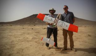
Unmanned Aerial Vehicles (UAVs, or drones) are revolutionizing archaeological landscape mapping. Using drones, we will conduct a high-resolution aerial survey of previously unknown prehistoric monuments and archaeological sites in the eastern Black Desert of Jordan. Aerial surveys such as this can be particularly useful for recording prehistoric structures that tend to be small and difficult to identify from satellite images.

More Lab Notes From This Project
Browse Other Projects on Experiment
Related Projects
Intuitions about Ownership Among Achuar Communities and the Misalignment of Intellectual Property Law
The ownership of knowledge is one of the most contested topics of our times, but little is known about how...
Troy: Archaeology of Archaeology
Ancient Troy has been the subject of archaeological research for a very long time: systematic excavations...
Reconnecting Indigenous Collections to their Source Communities
How do artworks wind up on museum walls? How are objects chosen for display and who makes such decisions...