


Please wait...
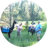
About This Project
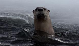
Otters are immigrating to the Greater Yellowstone’s historically fishless Beartooth Plateau as a side effect of sport fish stocking as well as climate change. As an “invasive species” in this alpine environment, these predators could have serious consequences for native species. Our team of citizen scientists will collect data on this new population for monitoring and hypothesis testing, and we will share results through both technical and popular formats.

Browse Other Projects on Experiment
Related Projects
Satellite tracking the secret lives of vulnerable juvenile Loggerhead sea turtles off Morocco’s Coast
This pioneer project marks the first time in Morocco's history for satellite transmitters deployed on sea...
Out for blood: Hemoparasites in white-tailed deer from the Shenandoah Valley in Northern Virginia
Our research question centers about the prevalence and diversity of hemoparasites that infect ungulate poplulations...
Using eDNA to examine protected California species in streams at Hastings Reserve
Hastings Reserve is home to three streams that provide critical habitat for sensitive native species. Through...