Hugh Thomas

Hugh Thomas

Feb 05, 2017

Group 6 Copy 175
1
Please wait...

About This Project

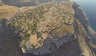
If an archaeologist could have one super power- it would be X-RAY vision. Archaeologists are always looking for non-destructive techniques to see what lies beneath the surface. This project will use the newest in UAV'S (Unmanned Aerial Vehicles) as well as Infrared (Thermal) and Near Infrared cameras to create high resolution maps of the Early Iron Age site of Zagora, Greece. The final product will hopefully be the creation of several high-resolution multispectral 3D models of the site.

Blast off!

Browse Other Projects on Experiment

Related Projects

Of Monks and Men: How medieval construction brought monasteries and lay communities together

How did the construction of monastic buildings push monks to cooperate with people outside their cloister...

Using smart feeders to increase lemur activity and stimulate human interest

Low activity levels in captive animals are common because they don't have to search for food, unlike their...

Archaeology & Drones: Mapping Neolithic Structures in the Black Desert, Jordan

Unmanned Aerial Vehicles (UAVs, or drones) are revolutionizing archaeological landscape mapping. Using...

Backer Badge Funded

An anthropology project funded by 60 people