About This Project
Through the use of water sampling, GIS analysis, and various statistical evaluation, we aim to determine linkages between land use and impervious cover within each sub-watershed to nutrient supply, thereby influencing water quality within the watershed. Using this information, we aim to develop effective restoration and management recommendations for the Charles River Watershed Association.
Ask the Scientists
Join The DiscussionWhat is the context of this research?
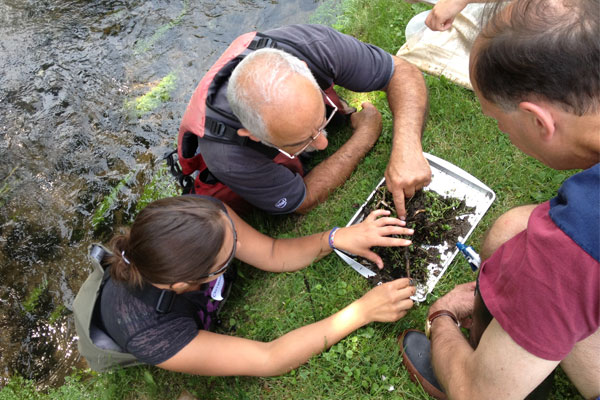
In 2012, a University of Massachusetts Boston graduate student Christina Ciarfella began working with CRWA and citizen scientists to assess water quality in the Charles River watershed. We have seen in other studies, however, that there are correlations between land use and water quality. For example, Roth et al (1996) found that water quality, measured by fish communities, were negatively correlated with the extent of agriculture in a watershed and positively correlated with extent of wetlands and forested area in a watershed. Meanwhile, Maloney and Weller (2011) found that LULC influenced water chemistry which influences macro-invertebrate and fish communities.
What is the significance of this project?
Global change drivers, such as land use land cover, are known to impact water and land resources, biodiversity, agriculture, and human health. In order to protect these, further research is needed. While Ciarfella was able to gather water quality and land use data, the most influential factors, such as different land use types or impervious cover, affecting the biotic index within the Charles River Watershed have not yet been determined. This information is critical when considering how to best manage the highly-utilized river situated in the heart of Boston.
What are the goals of the project?
Our goal is to identify independent and dependent variables impacting water quality in the Charles River watershed to provide management recommendations to the CRWA. Initial steps within this project include ground truthing site locations and land use characteristics. Following this, I will use 2012 sampling data from 10 stations including USEPA habitat assessment scores, physico-chemical data, and benthic invertebrate index scores in conjunction with MassGIS data for regional, reach, and local scale measures of % impervious cover and LULC. I will use Geographic Information Systems software ESRI ArcMap 10.2.2 and SPSS to analyze the influences on water quality within the Charles River Watershed in order to construct a complex model of water quality states and land use characteristics.
Budget
Global change drivers, such as land use land cover, are known to impact water and land resources, biodiversity, agriculture, and human health. However, the extent to which this occurs in the Charles River Watershed is unknown. Funding for this research is needed in order to establish these linkages through SPSS analysis. In order to provide effective management recommendations for the Charles River Watershed Association, my attendance at the ASLO Winter Meeting will also help me gaining useful insight into management options and recommendations from other professionals within the field.
Meet the Team

Affiliates
Team Bio
As a native Michiganian, my passion for lakes and streams runs deep. My childhood was spent playing in, on and around any one of Michigan's thousands of lakes, including the Great Lakes. Protecting these freshwater bodies is important to me.
I completed my undergraduate degree in Earth Science with a minor in Geographic Information Systems from Michigan State University. I am currently pursuing my M.S. in Environmental Science in the School for the Environment from the University of Massachusetts Boston. Under the guidance of Dr. Alan Christian and the assistance of the Freshwater Ecology Lab, I hope to gain valuable experience and knowledge of these freshwater ecosystems that I can take back home in order to conserve and effectively manage Michigan's freshwater resources.
Laurissa Gulich
My name is Laurissa Gulich, and although I'm currently living the city life in Boston, my heart lies within the natural world. As a native Michiganian, my passion for lakes and streams runs deep, and my childhood was spent playing in, on and around any one of Michigan's thousands of lakes, including the Great Lakes. Protecting these freshwater bodies is important to me.
I completed my undergraduate degree in Earth Science with a minor in Geographic Information Systems from Michigan State University, and I am currently pursuing my M.S. in Environmental Science in the School for the Environment from the University of Massachusetts Boston. In my free time I enjoy rowing, hiking, swimming, eating and spending time with my family. I also love traveling and can't wait to plan my next adventure.
Under the guidance of Dr. Alan Christian and the assistance of the Freshwater Ecology Lab, I hope to gain valuable experience and knowledge of these freshwater ecosystems that I can take back home in order to conserve and effectively manage Michigan's freshwater resources.
Lab Notes
Nothing posted yet.
Additional Information
Source: http://blog.crwa.org/blog
For the purposes of this study, water quality is considered the condition of a water body that is composed of a set of physical and chemical properties such as temperature, dissolved oxygen, salinity, suspended solids, pH, chlorophyll, and conductivity (Chapman 1996). A Geographic Information Systems (GIS) based approach is one way to collect, manipulate, spatially analyze and represent this relationship between water quality and human impacts within a study area (Malczewski 2004). When determining correlations within water quality variables, it may be necessary to perform a data reduction technique first to simplify the data. The goal of principal component analysis is to extract the most important information in regards to looking at the correlation relationships among variables (Abdi 2010). Employing another form of multivariate analysis, such as generalized linear models, will present or reveal relationships between water quality variables.
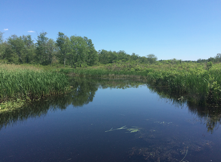
Stop River, Medfield, MA
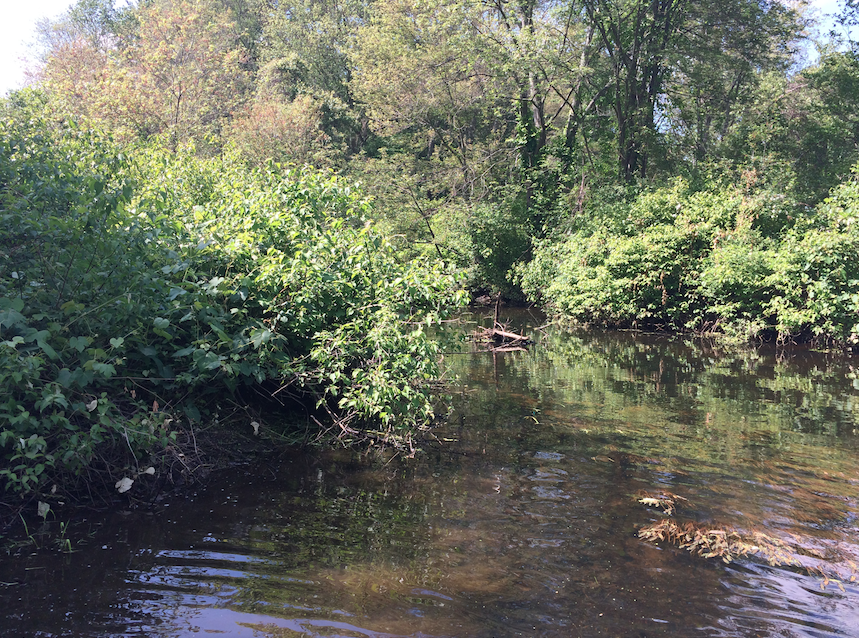
Mine Brook, Franklin, MA
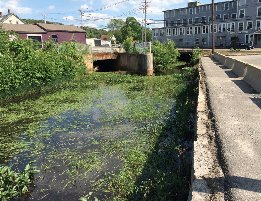
Charles River, Milford, MA
Abdi, H., & Williams, L. J. (2010). Principal component analysis. Wiley Interdisciplinary Reviews: Computational Statistics, 2(4), 433-459.
Chapman, D. V. (Ed.). (1996). Water quality assessments: a guide to the use of biota, sediments and water in environmental monitoring.
Malczewski, J. (2004). GIS-based land-use suitability analysis: a critical overview. Progress in planning, 62(1), 3-65.
Roth, N.E., J.D. Allan, and D.L. Erickson (1996). Landscape influences on stream biotic integrity assessed at multiple spatial scales. Landscape Ecology 11(3), 141-156.
Cover Photo Credits: Igor Belakovskiy
Project Backers
- 23Backers
- 40%Funded
- $680Total Donations
- $26.30Average Donation