About This Project
The Karst Springs Initiative is focused on studying Tennessee springs, their magnitude, and what springs might be the largest in terms of discharge. We are taking a deeper dive into studying relationships between karst spring discharge and their recharge basins. This project is dedicated to quantifying the major resurgences to provide a better understanding of karst hydrology in Tennessee and protect these valuable resources in the future.
Ask the Scientists
Join The DiscussionWhat is the context of this research?
Among the 10,000+ caves of Tennessee, the pioneers of karst research laid the groundwork for a detailed analysis of karst aquifers in this beautiful state. Through a search of the existing literature a significant gap was found to exist in the state regarding springs, their magnitude, and what springs might be the largest in terms of discharge. This research aims to take a deeper dive into studying relationships between karst spring discharge and the recharge basins that contribute flow to these beautiful resurgences. This new project, the Karst Springs Initiative (KSI), focuses on the largest springs of Tennessee, building on previous research conducted by karst scientists in the past and attempting to quantify these resources for continued and future research.
What is the significance of this project?
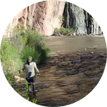
The KSI plans to establish a database of spring measurements in order to better understand and thus protect these valuable groundwater resources. Field reconnaissance and spring discharge measurements have been conducted recently at several large springs along the Cumberland Plateau in Tennessee to determine what the largest karst springs are in the state and to prioritize future continuous monitoring sites. The KSI is focused on establishing continuous discharge monitoring instrumentation to examine an understudied component of these resources and build a body of knowledge to help document and protect these sensitive karst resources.
What are the goals of the project?
The KSI is focused on expanding the network of continuous monitoring sites for large springs in Tennessee. These datalogging sites will help us determine flow characteristics and better understand recharge through the associated karst groundwater basins. Individual field discharge measurements will be used to create a rating curve and establish the relationship between water level and discharge at each spring. The resulting data will be used to evaluate flow characteristics at each resurgence and will be compared to other significant springs to evaluate which karst springs are the largest in Tennessee. Our goal is to publish the data and findings to provide a better understanding of these valuable resources and help protect them for the future.
Budget
The funding will be used for datalogging instrumentation to establish continuous discharge monitoring sites at the large karst springs of Tennessee. We are researchers conducting "citizen science," and are not supported by other funding mechanisms. We have currently established one continuous monitoring site out of our pocket and are reaching out for additional funding from individuals who are passionate about studying and protecting karst resources. These additional dataloggers will provide continuous water level measurements at other large springs which will later be coupled with a rating curve representing a stage/discharge relationship from individual field measurements. The resulting database of spring discharge measurements will be used to better understand the flow regimes at each spring and allow for comparisons among the largest springs in the state.
Suite per site: Solinst LTC Levelogger Junior ($1,111.50), Barologger ($288.80), and stilling well ($100).
Endorsed by


Meet the Team
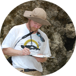
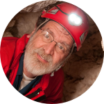
Brian Ham
I’m a professional geologist and geographic information systems professional with a specific interest in karst hydrogeology. As a native of Tennessee, I have developed a deep appreciation for the caves and karst of the region. An alumni of the Western Kenutcky University Geosciences program (MSc), I gained a wide range of experience ranging from dye tracing, cave mapping, and karst geophysical surveys. I continue to be passionate about documenting and protecting karst resources by mapping cave systems, conducting hydrologic investigations, and developing innovative graphics with geographic information systems software.
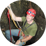
Ben Miller
I’ve been interested in caves and springs for much of my life, ever since growing up in the southwest Missouri Ozarks surrounded by thousands of cave systems. Since then, I’ve spent much of my career studying and managing the complex hydrogeologic systems of karst landscapes. I obtained a Masters Degree from Western Kentucky University in 2010 in Hydrology and Geomorphology, where my research focused on a complex distributary spring system. My research interests are primarily focused on the study of karst systems through the use of dye tracing, geochemical analyses, discharge measurements, and GIS. Personally, I spend much of my free time mapping the extensive and deep cave systems of Tennessee and the Missouri Ozarks. My work has allowed me to study and conduct research on karst systems in a variety of locations including Kentucky, Tennessee, Missouri, Wyoming, Haiti, Puerto Rico, China, and Belize.
Project Backers
- 49Backers
- 113%Funded
- $3,415Total Donations
- $69.69Average Donation