Methods
Summary
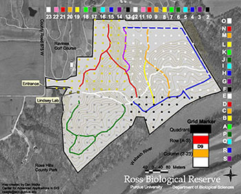
Every tree inside each 40x40m subplot will be identified to species, and its diameter at breast height (DBH) will be measured. The historical census only measured trees >8" in diameter, but I plan to update the methods to match the Smithsonia Centre for Tropical Forest science ForestGeo methods (Condit 1998).
This means that starting in 2019, every tree taller than 1.3m, and >1cm DBH will be mapped, identified and measured. The new method includes the old method allowing for 80 year comparisons, but it modernizes it potentially allowing for global cross-plot comparisons.

Challenges
The primary challenge is the number of trees that occur within a 27Ha plot. We have a tremendous advantage in that the grid is already present, and many of the trees are already tagged.
This challenge is why I require a crew of 6 technicians to tackle the problem.
Pre Analysis Plan
Another advantage of using the ForestGeo methods is that there is an R package, designed for analysis of forest dynamics using data in that format.
Protocols
This project has not yet shared any protocols.